Snow could be on its way back to Summit County, meteorologists say


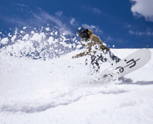
Lucas Herbert/Arapahoe Basin Ski Area
While Summit and Grand counties’ slopes might have gone without snow the last several days, meteorologists are predicting dustings at resorts across both counties this week as the ski season nears its end.
National Weather Service Boulder meteorologist Jim Kalina said snow in both counties is slated to start Sunday night, April 13.
“Areas like Fraser look like they are getting a little more snow (than Summit County towns) and it could be 1 to 3 inches overnight,” Kalina said.
He said snow in lower elevation areas of Summit County will accumulate to less than an inch by Monday morning, April 14, while higher elevations could see around an inch. He said Winter Park Resort skiers and riders could wake up to as much 2-4 inches by Monday morning.
Meteorologist-founded weather app OpenSnow is predicting Winter Park Resort will have 3 inches of snow by Monday night. It forecast Loveland Ski Area and Arapahoe Basin Ski area could both get 2 inches, while Copper Mountain and Breckenridge Ski Resort could both get an inch.
Kalina said there is a chance of showers Tuesday through Thursday, but a bulk of the snow will come at the start of the week.
Both counties should see temperatures of mid-to-high 40s at higher elevations throughout the week. Kalina said with more water expected to be in snow this time of year, it’s likely Monday’s precipitation won’t stick around long.
With temperatures in both areas anticipated to be in the mid-20s at night throughout the week, there is potential for a freeze-thaw cycle as well.
Lower elevation areas in Summit could see temperatures remain in the 50s throughout the week. Kalina said the only real wind in the forecast for Summit will be on Thursday, where gusts could reach up to 45 miles per hour on the peaks.
While this week’s weather won’t result in a substantial amount of snow, next week’s could, Kalina said.
“The weather models are showing a storm system reaching across north of New Mexico toward (Colorado) that’s pretty big,” he said.
OpenSnow is tentatively predicting Arapahoe Basin to get around 15 inches of snow by Tuesday, April 22, with snow in the forecast everyday from April 18 until then. Loveland Ski Area is also anticipated to get fairly consistent snow, around 3-4 inches a day up until April 22, which could amount to 13 inches by the end of the week. Breckenridge Ski Resort could get 7 inches by the end of that week and Copper Mountain could get 8 inches. OpenSnow forecasts Winter Park Resort could get 12 inches by the end of next week, with a majority of the snow coming April 19.


Support Local Journalism
Support Local Journalism
As a Summit Daily News reader, you make our work possible.
Summit Daily is embarking on a multiyear project to digitize its archives going back to 1989 and make them available to the public in partnership with the Colorado Historic Newspapers Collection. The full project is expected to cost about $165,000. All donations made in 2023 will go directly toward this project.
Every contribution, no matter the size, will make a difference.